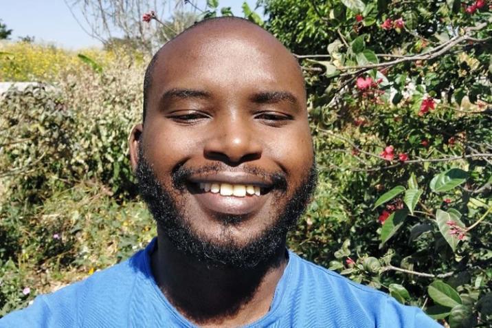
Rodgers Iradukunda
PhD student at the Geographic Data Science Lab, Rodgers Iradukunda, researches the cumulative effects of spatial inequalities. His work aims to develop dynamic tools for tracking evolving inequalities across social, infrastructural, and environmental dimensions, informing more effective policies for equitable development.
Name – Rodgers Iradukunda
Position – PhD Student
Group name – Geographic Data Science Lab (GDSL)
Joined University of Liverpool – 2022
Born – Lusaka, Zambia
PhD – Liverpool, United Kingdom

What is your research about?
My doctoral research focuses on capturing the cumulative effects of spatial inequalities, owing to their multidimensional nature. In the discourse of inequalities, conventional economic metrics often oversimplify the complex nature of inequality, focusing predominantly on income and wealth. However, recent interdisciplinary scholarship emphasizes the multifaceted dimensions of inequalities, spanning social, infrastructural, political, cultural, and environmental realms. My research aims to develop dynamic tools capable of tracking the evolving nature of spatial inequalities, considering how various forms intersect and accumulate to shape individuals' experiences and wellbeing within communities.
My master’s degree research focused on using smartphone GPS data to analyse the scale, evolution, and patterns of internal population displacement in Ukraine caused by the ongoing Russia-Ukraine conflict. Using smartphone GPS data, I quantified the levels of daily population movements, identified key origin and destination areas, and estimated the extent of return movement across raions and oblasts in Ukraine. Smartphone GPS data are a segment of the Ukrainian population. Hence, I adopted post-stratification principles to adjust the smartphone GPS-derived population estimates using various open-source data.
What or who first inspired you to be interested in your research subject?
I was inspired to formally study socio-spatial inequalities when I worked with smallholder farmers as a data analyst at Good Nature Agro (GNA) in the Eastern Province of Zambia between 2020 and 2022. GNA is a social enterprise aiming to elevate rural farmers in southern Africa from poverty to the middle class by providing them with financial and agricultural extension services and linking them to premium markets. While at GNA, I noticed that farmer productivity followed specific spatial patterns and was greatly affected by social factors. For instance, I observed that divorced or widowed female farmers yielded less than their married counterparts and farmers who lived close to main roads achieved financial security faster than those living in very remote areas. I did not have the requisite skills to study these phenomena and that is why I applied for a master’s in Geographic Data Science at the University of Liverpool.
At the master’s level, my supervisors Professor Francisco Rowe and Dr Elisabetta Pietrostefani inspired me to undertake human mobility research. The motivation for my dissertation project was to potentially inform targeted humanitarian aid to internally displaced persons in Ukraine and other crisis-laden areas.
What are you most proud of achieving during your research career so far?
My master’s dissertation was awarded the prestigious Bob Woods Postgraduate Dissertation Prize of 2023 by the Royal Geographical Society, an award reserved for the best postgraduate population geography dissertation in the United Kingdom. Having studied Civil Engineering at New York University Abu Dhabi for my undergraduate studies, I had no prior formal background in geography or data science pre-masters, so this was a remarkable achievement.
What techniques and equipment do you use to conduct your research?
Within my research, I use the R programming language quite often, as well as more occasionally Python and QGIS.
What impact is your research having outside of academia?
I had the opportunity and honour to discuss my master’s research findings with a senior team from the UN’s International Organisation for Migration (IOM) data science department in November 2023. We discussed the method used in my research and how similar it was to the one IOM uses to estimate population displacement. We also talked about the potential for future collaboration.
What problem would you like to solve through your research?
Within my PhD research, I would like to contribute to improving the current knowledge base and improve policy around tackling socio-spatial inequalities. Specifically, I would like to devise a way of capturing the cumulative effects of spatial inequalities. By quantitatively capturing the cumulative effects of spatial inequalities through a multidimensional framework, my research aims to address the limitations of conventional metrics of measuring inequality, offering a deeper understanding of how various dimensions intersect and accumulate over time. This approach will not only inform more effective policy interventions but also unlock pathways toward a fairer society, where opportunity and well-being are accessible to all individuals, irrespective of their socio-spatial context.
What advice would you give to someone considering a career in research?
As toilsome as research can sometimes seem, it can also be exponentially rewarding. I would encourage you to undertake research in an area that you are genuinely interested in, and to work with supervisors you get along with.
I would like to contribute to improving the current knowledge base and improve policy around tackling socio-spatial inequalities.